


Saluda Grade Trail's First 5 Miles Progress Near Landrum, SC
Category: Business
Share
Archive
Like
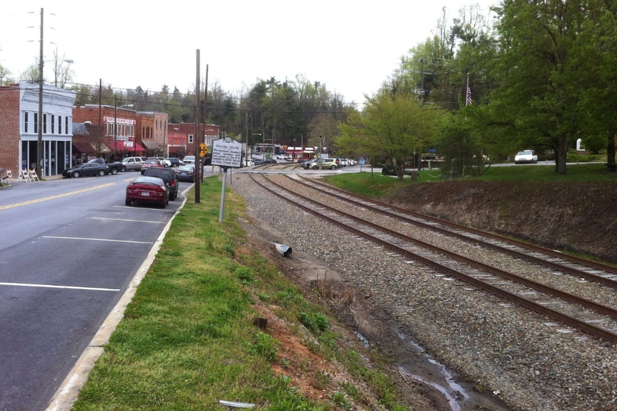
The first five miles of the Saluda Grade Trail are taking shape on paper, with engineers now roughly 60% finished designing the opening stretch that will run from the North Carolina state line near Tryon south through downtown Landrum to Hulon Howard Road. The route, bridge locations, and retaining wall placements have all been determined, and permitting for the initial section is running ahead of schedule, according to the Saluda Grade Trails Conservancy.
As reported by the Greenville Journal, the South Carolina portion of the project is being spearheaded by PAL: Play, Advocate, Live Well, with Seamon Whiteside serving as the design team for that section. Environmental impacts along the initial five miles have already been resolved, and the route now includes nine proposed road crossings, among them Ridge Road, Greenwood Road, East Durham Street, East Coleman Street and East Rutherford Street, along with East Tucker Street, S.C. Elastic Road, Landrum Mill Road and Hulon Howard Road.
Design plans unveiled at an August open house in Landrum drew roughly 300 attendees, hosted by PAL, to see how the corridor will look once complete. The trail is planned at a standard width of 12 feet, widening to 16 feet with concrete borders through downtown Landrum and narrowing to 10 feet where it crosses wetlands. Its surface will consist of two inches of asphalt laid atop a gravel base, and current plans identify potential trailheads and parking near the state line, the Landrum Depot and Boyd Cycling.
Even with design work well underway, construction of the initial phase depends on securing funding, the report notes. The Saluda Grade Trails Conservancy has applied for $10 million in ARISE grant funding administered by the Appalachian Regional Commission, split evenly between South Carolina and North Carolina at $5 million apiece. PAL's executive director, Laura Ringo, said ARISE grants typically support projects affecting multiple communities across county and state lines, and that criteria influenced the decision to begin construction planning with the five-mile section at the state line.
'We're excited by what's happening,' Ringo said, according to the Greenville Journal's reporting, adding that community support and engagement remains strong. Ringo also said the trail may be positioned to receive ARISE funding because of its likely transformative impact on the communities it connects. The Conservancy — a partnership between PAL and Conserving Carolina, which spearheads the North Carolina section — has also solicited contractor bids to remove and salvage track materials still sitting on the corridor.
The full Saluda Grade Trail is planned to stretch 31.5 miles, running from Inman in Spartanburg County, South Carolina, through Gramling, Campobello, Landrum, Tryon and Saluda before ending in Zirconia in Henderson County, North Carolina. The trail follows the historic but defunct Saluda Grade rail line, which was built in the late 1870s and once carried a maximum grade of 5%, with an average grade of 4.2% along its length — among the steepest stretches of mainline railroad ever built in the United States. Between Tryon and Saluda, the corridor climbs more than 1,000 vertical feet in a little over eight miles, with the trail's highest point reaching 2,097 feet in Saluda, North Carolina, and its lowest starting elevation at 1,001 feet in Inman.
That steep terrain made the original railroad exceptionally hazardous. Between 1880 and 1893, 29 railroad workers died in runaway train incidents on the incline, and a particularly treacherous section east of Melrose became known as the 'Slaughter Pen,' according to a historical overview published by NRV Club. To manage the risk, railroad engineers installed runaway safety switch tracks at the bottom of the slope and routinely split trains in two to 'double the hill,' a practice detailed by American-Rails.com, since standard railroad grades rarely exceed 1% to 2%. Norfolk Southern took the line out of service for economic reasons in December 2001, and the tracks sat dormant for more than two decades before the trail agreement, per Wikipedia.
The dormant corridor changed hands in June 2025, when the Saluda Grade Trails Conservancy completed a $28.5 million purchase of the full 31.5-mile line from Norfolk Southern Railway, as reported by BPR News. That acquisition was funded mainly by the South Carolina and North Carolina state legislatures and a grant from the South Carolina Conservation Bank, according to Upstate Forever. A separate U.S. Department of Housing and Urban Development grant helped fund planning for 15 miles of trail in South Carolina.
The Conservancy is a coalition of three regional nonprofits — Conserving Carolina, PAL, and Upstate Forever. Federal support followed in July 2024, when the Appalachian Regional Commission awarded the project a $450,000 ARISE grant to support economic development planning, one of just four such awards issued across Appalachia that year.
The prospective rail trail has been discussed as an economic-development project before a single mile has opened to the public. A 2024 Clemson economic-impact study estimated the completed trail's economic impact at $20 million.
According to a University of Connecticut Trail Census summary, a study of a $26.7 million investment in four North Carolina greenways found that every $1 spent on construction yielded $1.72 in additional impact.
Possible future connections include Western North Carolina's 17-mile Ecusta Trail and a future 55-mile Spartanburg trail. For now, the focus remains on the first five miles near Landrum, where design work continues even as the Conservancy waits to learn whether the $10 million ARISE grant request will come through to fund actual construction.
A note on cookies
Newshunt uses essential cookies to keep you signed in and to remember your language and country, so the site works the way you expect. With your permission, we'd also like to use analytics cookies to understand how people use Newshunt and improve it over time.
Accepting only affects analytics. To learn more, view our Privacy Policy or Terms & Conditions.
(0)Comments