


Turning toasty again before showers and storms return
Category: Tourism
Share
Archive
Like
LEXINGTON, Ky. (WKYT) - Fall continues to be put on hold for now as we look to make another run at 90 degrees by the middle of the week. Showers and storms make their return for the late part of the week as well.
This evening with have some clouds around as it should be pretty nice. A few clouds will linger into the overnight as we see lows in the mid to upper 60s.
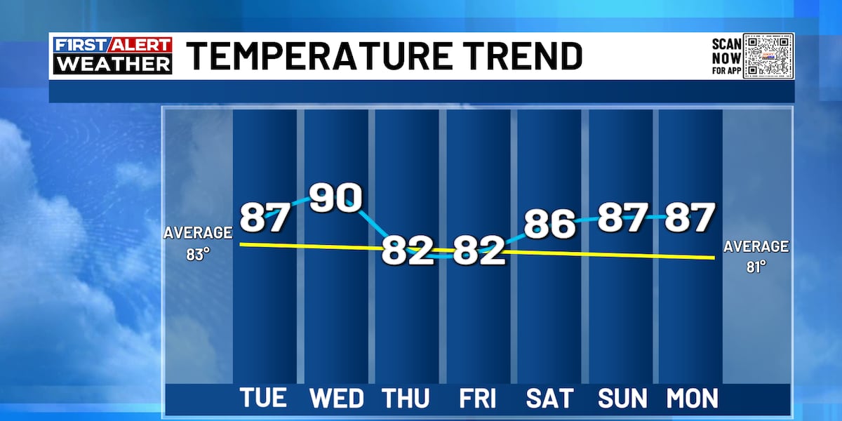
Tuesday will be another quiet day as we start out with mostly cloudy skies. It will turn partly cloudy for the afternoon and be warm again with highs in the mid to upper 80s. A few clouds will be around again Tuesday night with lows of 65-70 degrees.
Wednesday will have plenty of sunshine to start the day with just a few passing clouds in the afternoon. It will be a toasty day as highs reach the upper 80s to low 90s. A few showers may look to arrive late Wednesday night with our next system.
A cold front arrives on Thursday bringing widespread showers and thunderstorms back into the region. It will be a cooler but humid day with highs in the low to mid 80s. Some storms will be capable of producing heavy rainfall that could lead to some flash flooding concerns.
Scattered showers and storms will continue to be with us Friday before it settles back down again for the weekend and early next week. Temperatures will begin to climb once more from the low to mid 80s Friday to the upper 80s to around 90 next Monday.
A note on cookies
Newshunt uses essential cookies to keep you signed in and to remember your language and country, so the site works the way you expect. With your permission, we'd also like to use analytics cookies to understand how people use Newshunt and improve it over time.
Accepting only affects analytics. To learn more, view our Privacy Policy or Terms & Conditions.
(0)Comments