


Why Flood Risk Shapes Southport Planning Decisions
Category: Blend
Share
Archive
Like
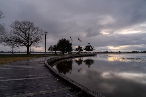
Southport is flat, coastal and criss-crossed by ditches and ordinary watercourses that most residents never think about until a road fills up. That geography is not a footnote in local development. It is one of the things every planning application in the area eventually has to answer for.
Specialist consultancies prepare the technical documents applicants need. The Rida Reports flood risk assessment planning service is one example, run by chartered engineers, with drainage strategies quoted at 5 days on the firm's own site. Reports of this kind are written for submission alongside an application rather than for general reading. Sefton's Role as Lead Local Flood Authority
Sefton Council is the Lead Local Flood Authority for the borough. That role covers surface water, groundwater and ordinary watercourses, meaning ditches, streams and smaller rivers.
The duties attached to that role are public. They include: Investigating and publishing reports on significant flooding in Sefton.
Keeping a register of structures with a significant effect on flood risk.
Regulating ordinary watercourses through consent and enforcement powers.
Providing technical advice on surface water drainage to planning authorities.
Residents can read the borough's own account of managing flood and coastal erosion risk in Sefton . That last duty is the one that quietly shapes local development decisions. What Does the New Local Plan Put On the Table?
Sefton is preparing a new Local Plan to guide growth from 2029 to 2044. Consultation on it has been running with a closing date of 18 September 2026.
A local plan is a long document about where growth goes. Housing numbers, employment land, community facilities and infrastructure all sit inside it, and so does the environmental context those choices have to work within. Councillor Phil Hart has described the process as a community-led approach.
Local reporting on more homes planned for Southport under the new local plan adds the wider context. Where new housing is steered has a direct bearing on how much drainage work individual sites later need. What Does an Applicant Meet Along the Way?
For someone submitting an application, the process is more concrete. Councils publish validation requirements listing what has to accompany a submission, and those lists differ from one authority to the next.
Where flood risk information is required, the application is not valid without it. That is an administrative point rather than a judgement on the scheme. It also explains why applicants who leave the question late lose weeks.
Boundaries and levels matter here too, which is why boundary surveys for local development projects come up so often in the same conversations. Getting the technical pack right at the start is largely a scheduling exercise. Surface Water Is the Local Story
Coastal towns invite talk of the sea, but the more common local complaint is surface water. Heavy rain arrives faster than drains can clear it, and flat ground gives the water nowhere obvious to go.
New development changes that balance. Roofs, driveways and car parks replace ground that used to absorb rainfall, so schemes are expected to manage what they generate. Sustainable drainage features such as swales, permeable surfaces and attenuation basins are the usual response.
That is why drainage strategies now sit alongside flood risk work on most sites of any size. The two documents answer related questions about the same piece of ground.
Residents notice the effect long before the paperwork appears. A road that never used to pond, a garden that stays wet into April, a gully that backs up after a storm. Those observations are worth recording, because they are exactly the local detail a national dataset cannot supply. What Usually Sits In an Application Pack
Applicants and neighbours often want to know what the paperwork actually contains. The detail varies by scheme, but a few items recur wherever water is a consideration. A description of where rainfall lands and where it goes. Existing ground levels, and any the scheme proposes to change. A drainage strategy for managing surface water. Mitigation built into the design, such as raised thresholds. A note on avoiding increased risk elsewhere.
None of that is unusual or adversarial. It is the evidence a case officer needs before recommending a decision either way. Neighbours reading an application online can look for the same items. Where Can Residents Have a Say?
Planning is a public process, and flood risk is one of the material considerations people raise. Three routes stay open to residents: Comment on an individual application inside its consultation window.
Respond to the local plan consultation while it is running.
Contact or join a local flood action group.
Community groups also carry weight. The National Flood Forum is a charity supporting people affected by flooding, and it works with more than 300 flood action groups across England and Wales. On the charity's own figures, 6.3 million properties in England face some flood risk. Residents who have lived through a flood usually know their own drainage better than any dataset. Frequently Asked Questions Who Decides Whether an Application Passes?
The local planning authority does. Consultants prepare evidence and statutory bodies comment, but the decision sits with the council or, on appeal, with the Planning Inspectorate. What Is the Sequential Test?
It is part of national planning practice guidance on flood risk. The test steers new development towards areas with the lowest risk of flooding, taking all sources of flood risk and climate change into account. Does Flood Risk Automatically Block Development?
No. It is one consideration weighed with many others, and mitigation can change the answer. How much weight it carries depends on the site and the type of development proposed. Where Do I Report a Local Flooding Problem?
Start with Sefton Council for surface water, groundwater and ordinary watercourses. Other sources, including main rivers and the sea, fall to different bodies, and the council can point you to the right one. A Standing Item In Local Development
Flood risk is not a passing theme in Southport planning. It is a permanent feature of building on flat coastal land, and it will shape the new local plan as surely as it shapes individual applications. For residents that means two useful habits. Read the drainage sections of applications near you, and take part in the consultations while the wider decisions are still open. Both are ordinary civic tasks, and both are easier before the diggers arrive.
A note on cookies
Newshunt uses essential cookies to keep you signed in and to remember your language and country, so the site works the way you expect. With your permission, we'd also like to use analytics cookies to understand how people use Newshunt and improve it over time.
Accepting only affects analytics. To learn more, view our Privacy Policy or Terms & Conditions.
(0)Comments