


Bathsheba and the Atlantic shore of Saint Joseph
Category: Tourism
Share
Archive
Like
Bathsheba in Saint Joseph on Barbados's Atlantic coast is a fishing village shaped by reef, surf and folded hills waiting beyond the beach.
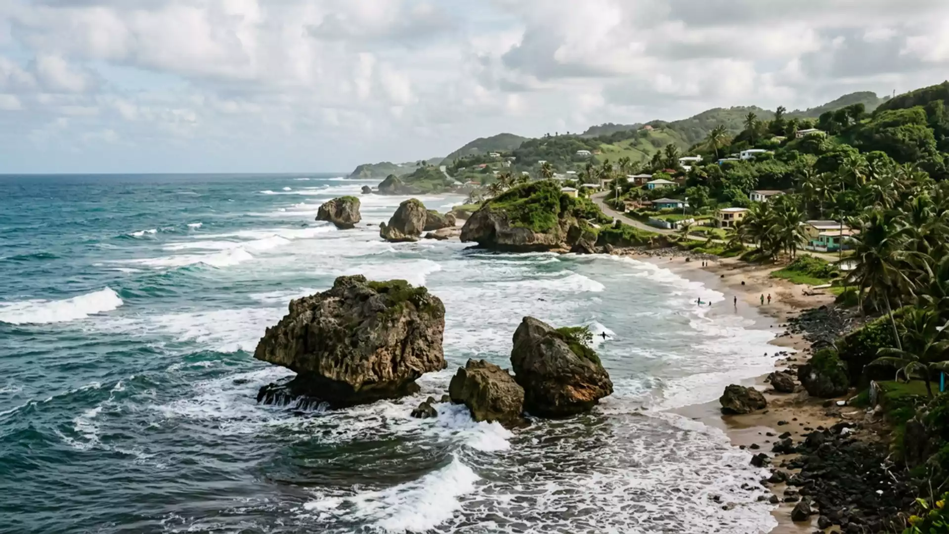
Bathsheba in Saint Joseph on Barbados's Atlantic coast is a fishing village where houses, reef and surf lie unusually close together along a rugged shoreline. The settlement belongs to the parish of Saint Joseph, one of Barbados's traditional divisions on the island's eastern side, and stands within the hilly Scotland District that forms the most visibly folded part of the island's landscape.
Village, reef and Atlantic surf in one line
Bathsheba is the main fishing village in Saint Joseph, set on Barbados's east coast facing directly onto the Atlantic Ocean rather than the quieter western Caribbean waters.main fishing village in Saint Joseph Buildings and streets follow the line of the shore in a loose pattern, with small houses and churches arranged both at beach level and on slightly higher ground overlooking the water.churches and beach
The coastline at Bathsheba shows Barbados's Atlantic edge clearly. Offshore reef and rock outcrops stand in the surf, while sandy sections of beach run between them in arcs broken by headlands and gullies that carry water down from the inland hills. The village lies within the Scotland District, a terrain of slopes and ridges that descend towards the sea, giving Bathsheba a backdrop of folded ground rather than the flat coral plateau found across much of the island.Scotland District landscape
The Soup Bowl and Bathsheba's surfing shore
Along Bathsheba's coast lies the Soup Bowl, the reef break that has made the village a recognised name in Caribbean surfing. The break forms where Atlantic swells meet reef-bottom conditions off Bathsheba's shore, producing right-hand waves that peel along a rock and coral shelf in front of the village.Soup Bowl reef break The wave is described as a right-hand reef break with rides of around 50 m (about 50 yards), combining powerful take-offs with sections that form hollow barrels over shallow reef.right-hand reef break
Soup Bowl's reputation stretches beyond Barbados. Detailed surf guides describe waves in the 3 to 10 ft range as the most characteristic surf there, shaped by north-east to south-east swells and strengthened further during parts of the year when Atlantic weather systems send longer-period swells into the eastern Caribbean.Soup Bowl swell patterns The break's power and consistency have brought major surf competitions to Bathsheba over several decades, and leading professional surfers have singled out the wave for its combination of strong walls, barrel sections and the ability to link manoeuvres across the reef.
Bathsheba's place in Barbados's east coast landscape
Bathsheba sits in the parish of Saint Joseph on the island's eastern side, forming part of a run of Atlantic-facing coastline that differs in character from Barbados's more sheltered western and southern shores.parish of Saint Joseph Inland from the village, the Scotland District's hills rise and fall in a sequence of ridges and valleys, some of which carry minor roads and tracks that link Bathsheba with other settlements and viewpoints across the parish.east coast seems a world away
The parish structure gives Bathsheba a clear administrative context. Saint Joseph is one of Barbados's parishes, and Bathsheba is recorded as its main fishing village, with a population figure around 5,000 inhabitants appearing in several statistical descriptions.population around 5,000 The combination of working village, surf break and distinctive Scotland District terrain makes Bathsheba a place where coastal life, sport and geology are all visible along a relatively short stretch of shore.
Visiting Bathsheba: what travellers from Western Europe should know
Bathsheba lies on Barbados's east coast in the parish of Saint Joseph and is reached by road from other parts of the island, including routes that cross the Scotland District hills.
The shore at Bathsheba combines sandy beach sections with exposed reef and rock, and parts of the coastal approach involve uneven ground and slopes rather than level promenades.
Bathsheba forms part of the Scotland District, so short walks inland from the village can involve noticeable gradients as paths and minor roads rise onto the surrounding ridges.
The official language is English and the currency is the Barbadian dollar.
Entry requirements depend on your nationality; UK travellers can check the FCDO travel advice at gov.uk/foreign-travel-advice, Irish travellers the Department of Foreign Affairs at ireland.ie.
Searching for Bathsheba on social platforms
These links open searches for Bathsheba on each platform.
Frequently asked questions about Bathsheba
Where is Bathsheba within Barbados?
Bathsheba is a fishing village on Barbados's Atlantic-facing east coast, within the parish of Saint Joseph and the hilly Scotland District of the island.
What should visitors expect on a visit to Bathsheba?
Visitors encounter a working coastal village with houses and churches near a reef-fringed beach, strong Atlantic surf along the shore and inland hills rising behind the settlement.
What makes Bathsheba distinctive compared with other parts of Barbados?
Bathsheba combines an Atlantic reef break at the Soup Bowl, a recognised centre of Caribbean surfing, with the folded Scotland District terrain and a fishing village set close to the surf.
A note on cookies
Newshunt uses essential cookies to keep you signed in and to remember your language and country, so the site works the way you expect. With your permission, we'd also like to use analytics cookies to understand how people use Newshunt and improve it over time.
Accepting only affects analytics. To learn more, view our Privacy Policy or Terms & Conditions.
(0)Comments