


Gautam Sharma
From Nepal to Dikhow: Understanding the forces behind major floods

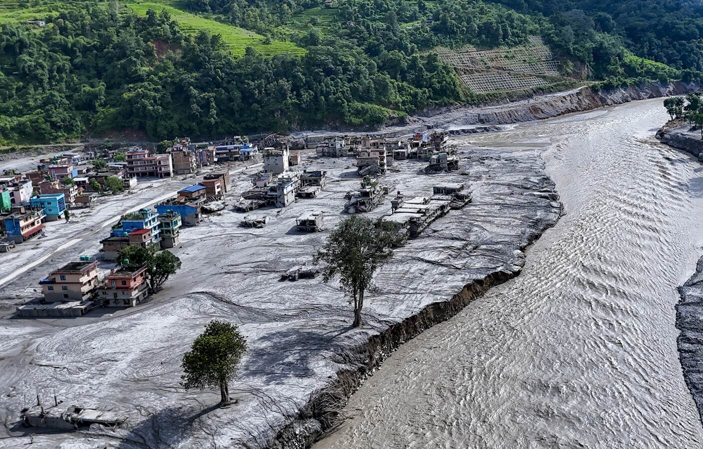
Nepal is racing against time to find survivors as the death toll continues to rise following the deadly flash flood of August 26, caused by the massive collapse of a Himalayan glacier near the border with China. The collapse sent a wall of water and debris crashing down into downstream valleys. The force of the water was so powerful that, within minutes, it reached the Nepal-China border, located 20 km downstream, at a speed of 150 km/hr, completely obliterating the Gyirong border post.
Initially, the US Geological Survey (USGS) reported that the collapse was attributed to a magnitude 5.2 earthquake. However, after studying the seismic signatures, the USGS concluded that it was not an earthquake, but that the glacial movement itself had generated the tremor. The event occurred at an altitude of 5,000m above sea level, when a 600m-wide mass of detached glacial ice came tumbling down 1,200m, carrying rock, water and soil, and creating a huge flow of debris.
Later, satellite imagery revealed that the landslide occurred not only because of glacial movement, but also due to the failure of the underlying bedrock in combination with the ice. The region is part of a major tectonic system in which the Indian plate converges with the Eurasian plate. Periodic earthquakes are normal in this region; the 2015 Nepal earthquake is one such example. These tectonic activities create faults and fractures within the bedrock, making it weak and unstable.
A few days ago, the Prime Minister of Nepal remarked that the devastating flash flood was linked to climate change, as the Himalayan region is experiencing an increase in average temperature of 1.8 degrees Celsius. The Paris Agreement of 2015 stipulated a permissible limit of 1.5 degrees Celsius above the pre-industrial level, in order to prevent the most dangerous effects of climate change.
The world is increasingly experiencing extreme conditions, including unusually heavy downpours, above-normal average temperatures, ocean warming and glacier melt. The Nepal flash flood occurred due to the mass failure of fractured and faulted bedrock, coupled with glacial thinning. The timing was conducive to catastrophe, as summer meltwater weakens the bond between the ice and the underlying rocks.
Dikhow River flooding: The unfolding of a natural disaster
The late-August glacial flash floods in Nepal and the intense, downpour-driven flooding of the Dikhow river in Assam, India, in July 2026, share comparable climate-change effects and occur within similar tectonic environments. Though the scale of losses may have been different, the possible causes and the aftermath of the destruction have much in common. In both cases, the level of destruction was unimaginably high.
Dikhow is one of the southern tributaries of the mighty Brahmaputra river. It originates in Nagaland and flows into the plains of Assam near Bihubar in Sivasagar district. Nagaland is part of the Naga-Patkai Range, which stretches across the northeastern states of Arunachal Pradesh, Nagaland and Manipur, as well as parts of Upper Myanmar. The region is tectonically located within the convergent plate boundary between the Indian plate and the Burmese plate, a microplate structurally associated with the larger Eurasian plate. As per Indian nomenclature, the region falls in Seismic Zone V, the highest-risk zone for earthquakes in India.
Incessant rainfall, far above normal levels, in the upstream catchment areas of the Dikhow, had made areas close to the river course highly vulnerable to landslides. Available information also suggests the formation of major cracks on mountain slopes at several locations. These may be the result of gravity-driven sliding, which can eventually lead to landslides. What is particularly striking, however, is that the landslides appear to have occurred continuously along the river course on a regional scale, rather than being confined to one or two localised areas, as is more commonly observed. Landslides were also prominent in the catchment areas of smaller streams and channels flowing into the Dikhow. The enormous volume of mud and silt transported by the floodwaters to the distant downstream plains indicates massive erosion and landslides across a large geographical area. Erosion caused by deforestation may have been a contributing factor, but it does not appear to have been the primary cause. The sight and sound of the surging water and mud were so extraordinary that initial speculation pointed to a cloudburst, while later news suggested that a river dam somewhere in the Naga Hills might have broken. Both explanations were subsequently rejected by the competent authorities.
Cause analysis
Heavy rainfall, steep slopes and earthquakes – or, more generally, the shaking of the earth – can together create conditions conducive to major mudslides and landslides. The soil had become soft and unstable due to incessant rainfall. However, the occurrence of landslides on such a regional scale raises the possibility that associated earth movements may also have played a role.
River channels generally align with fractures and fault lines, zones of active tectonic movement. It may be that massive landslides created artificial lakes, which could have failed at some point under the overwhelming pressure of accumulated water. The locations of such events are yet to be identified. What ultimately led to the flooding along the Dikhow river remains a matter for detailed geoscientific investigation.
Regional monitoring system
Till 2015, Nepal had a joint project with NASA, USAID and the International Centre for Integrated Mountain Development that used satellite data to monitor environmental risks and the effects of climate change in the Himalayan region. It also monitored glacial melting, floods and weather risks to provide early warnings for vulnerable mountain communities. Assam and the surrounding hill states, including Bhutan, need a joint project along the same lines to monitor the behaviour of rivers flowing down from the hills to the plains of Assam. Such an initiative would not only help protect Assam but also the people living in the hill states. It is time to collaborate and address the challenges arising from global warming and their growing impact on our lives and livelihoods.
(The writer is former Executive Director, Oil India Limited.)
Related Opinion
A note on cookies
Newshunt uses essential cookies to keep you signed in and to remember your language and country, so the site works the way you expect. With your permission, we'd also like to use analytics cookies to understand how people use Newshunt and improve it over time.
Accepting only affects analytics. To learn more, view our Privacy Policy or Terms & Conditions.
(0)Comments